Second training on CORINE Land Cover (CLC) methodology in Georgia
| When |
Nov 12, 2018
to
Nov 13, 2018
|
|---|---|
| Where | Tbilisi, Georgia |
| Contact Name | György Büttner |
| Type | |
| Level | |
| Registration | Not available |
| Hosting organisation | Ministry of Environment Protection and Agriculture of Georgia |
| Countries | Georgia |

(text updated after the training)
This was the second training in Georgia following the first training that took place the 23-25 April 2018.
The objectives of the training were to discuss the results of the status layer produced by the Georgian CLC National Team and present and discuss the methodology for mapping CLC changes.
The Georgian CLC National Team is managed by an expert representing the Ministry of Environmental Protection and Agriculture (MOEPA) and includes a photo interpreter from the company GISLab and GIS (geographical information system) experts from GeoStat and MOEPA.
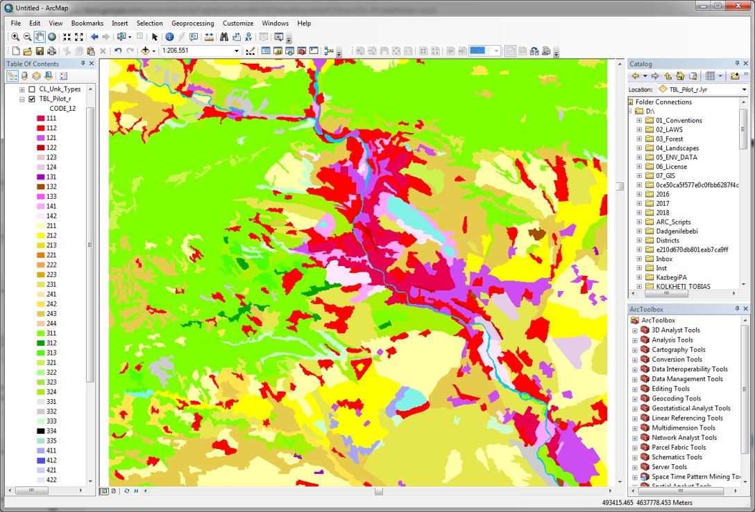
Figure 1: Example of the Georgian CLC Status layer. The pilot area is 2500 km2 in size around the caliptal city Tbilisi.The mapping was done based on a high-resolution satellite image taken by the ESA Sentinel-2 satellite on 21 July 2017.
Verifying the Georgian status layer showed that it is, in general, well mapped and is of good technical quality. Improvements proposed at the thematic level include: better separation of the two residential classes (111, 112), improved mapping of urban green areas (141) and sport and recreation areas (142), more precise mapping of arable land (211) class and the complex agriculture classes (242, 243), improving the mapping of natural grassland (321), bare rocks (332) and river (511) classes in accordance with the definitions in nomenclature, and the application of classes such as fruit trees (222) and beaches, dunes and sand plains (331) which were not used at all.
The next tasks for the Georgian CLC National Team include revising the status layer (CLC2017), mapping the layer of CLC changes (between 2001 and 2017), generating the GIS-based back-dated CLC2001 layer, and documenting in a short technical report the process and findings.
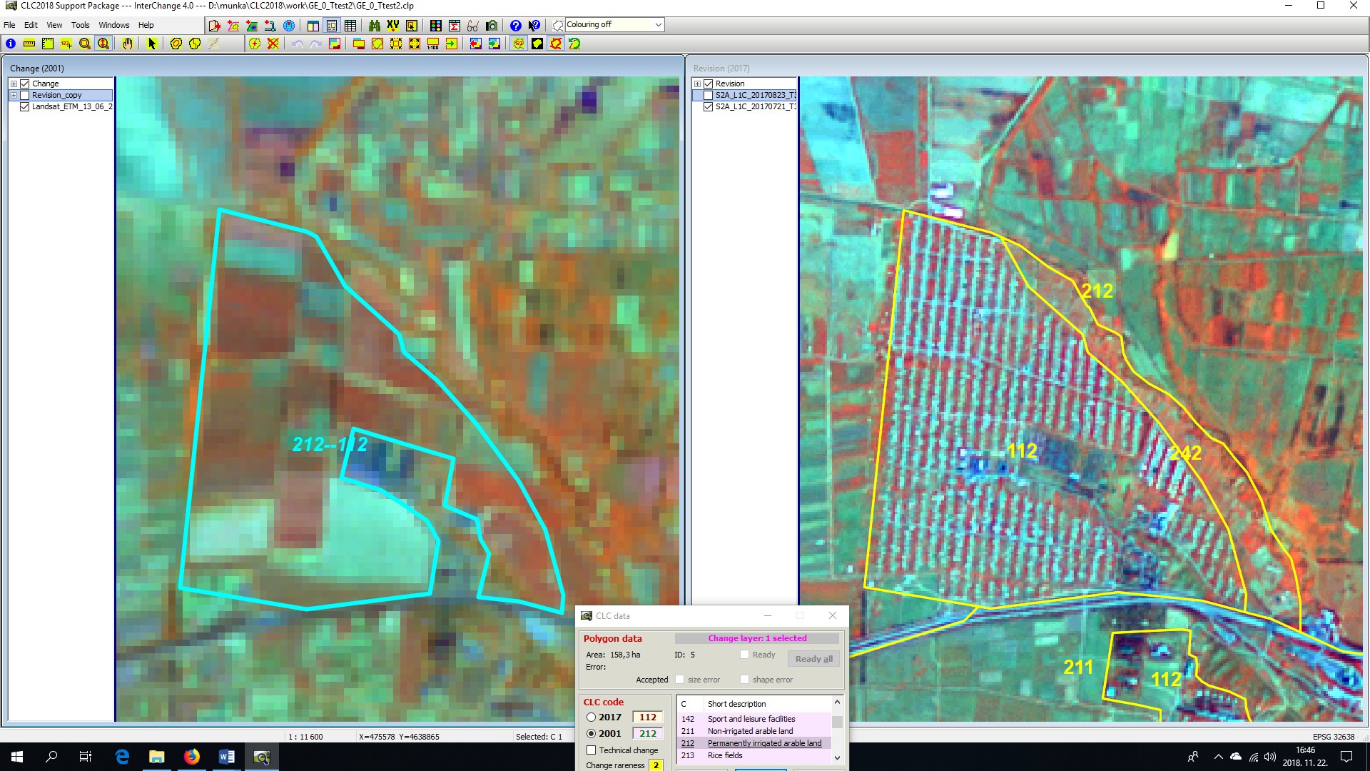
Figure 2: Screen-shot showing the change mapping environment in the InterChange software. The left window includes the 2001 satellite image (Landsat TM, 30 m pixel size) and the interpreted CLC Change layer (in cyan). The right window includes the 2017 satellite image (Sentinel-2, 10 m pixel size) and the CLC2017 layer (in yellow), produced by the Georgian national team. We see a settlement-like structure (112 code) in 2017, while arable land parcels (21x) in 2001. Local knowledge was needed to reveal that arable land was irrigated in 2001 (correct code is 212). The interpreted change is 212-112 (meaning: irrigated agriculture turned to built-up area). Non-changed areas in the South part were cut out to map only the real change area.