The CORINE Land Cover (CLC) pilot is successfully completed and published in the Republic of Moldova
The CORINE Land Cover (CLC) inventory was successfully completed in the Republic of Moldova for 2018. CLC refers to a standardized data collection methodology on land cover to support environmental policy development in the countries. It provides information on the biophysical characteristics of European land cover and beyond based on observation satellite data.
Land is a finite resource: how it is used constitutes one of the principal drivers for environmental change, with significant impacts on ecosystems and quality of life. In extreme cases, such changes might lead to unhealthy and degraded lands. The CLC data set is one of the main basis of all EU initiatives for sustainable soil and land management. It contributes to a wide range of studies e.g.: ecosystem mapping, modelling the impacts of climate change, landscape fragmentation by roads, abandonment of farmland and major structural changes in agriculture, urban sprawl, water management.
In Moldova’s case it can serve as a tool for monitoring the Sustainable Development Goals and especially Goal 15: Life on land. SDG 15 targets ecosystems that are highly relevant for the Republic of Moldova, including forests and land.
Coordination of country-level activities was ensured by two formally appointed National Focal Points (NFPs), from the Ministry through Environmental Agency and National Bureau of Statistics and remote sensing services were provided by the Agency for Land Relations and Cadastre of the Republic of Moldova through its State Enterprise Institute of Geodesy, Engineering Research and Cadastre “INGEOCAD”, as production unit.
Ten Moldovan experts were trained by EEA through ETC-ULS experts and got hands-on experience in handling various functions of the software: delineation of CLC polygons, correcting a polygon boundary, fast estimation of area and width, error checking and correction, statistics calculation, image enhancement (optimization of the displayed image extent for photointerpretation).
These data are part of the National Spatial Data Infrastructure according to Law no. 254 of November 17, 2016.
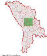
As a result, the pilot project applied CLC methodology to the largest city in Moldova, Chisinau urban area and its surroundings. Moldovan experts mapped an area of 3158 km2 and analysed land cover changes over an almost two decades (2000-2018).
The CLC pilot project in the Republic of Moldova is characterized by 18 out of 44 CORINE land cover classes. The main land cover in CLC pilot project in Moldova covers agricultural lands (pastures, arable land and complex cultivation patterns (62.2%)). However, the surface area occupied by urban areas has increased to 11.5%. Land classified as semi-natural and forest areas occupies around 24.2% of the pilot territory.
The total area that has changed its land cover between 2000 and 2018 is 1.07% within the pilot territory.