ENI SEIS II East project delivers pilot project on Corine Land Cover in Georgia
To understand recent changes in the Earth system, the scientific community and decision-makers needs quantitative, spatially explicit data on how land cover has been changed by human use over recent years and how it will be changed in the near future. The Corine Land Cover (CLC) methodology provides policymakers with environmental data on land use and land cover for planning and management and to reconcile land use with environmental concerns.
Land is a finite resource: how it is used constitutes one of the principal drivers of environmental change and has significant impacts on ecosystems and quality of life. In extreme cases, such changes might lead to unhealthy and degraded land.
Georgia successfully implemented a national pilot project using the CLC methodology to map land use changes in the Tbilisi urban area and its surroundings under the ENI SEIS II East project.
The pilot project applied CLC methodology to map an area of 2 500 km2 around the largest city in Georgia, Tbilisi, and its surroundings and analysed land cover changes over almost two decades.
Tbilisi faces a serious challenge in terms of environmental degradation and housing problems. The development of a modern city entails studying the surface area already within the boundaries of the settlement and surrounding territories. The use of remote sensing and GIS tools included in the CLC methodology help to detect the land use and land cover change that has taken place in Tbilisi and the surrounding area over recent years.
Compared with other parts of Georgia, this selected territory is distinguished by its diverse land use and landscape. The pilot area includes dynamically developing urban areas, forested mountains, intensively cultivated agricultural land, semi-arid rangelands and water features.
Because land use involves various policy levels and sectors and demands an integrated approach, Georgia’s Ministry of Environmental Protection and Agriculture (MEPA) together with its National Statistical Office (GeoStat) appointed experts to the national technical team for the CLC pilot from various institutions.
By implementing the pilot project, the national team experts have developed the necessary skills and experience to implement a nationwide CLC. The EEA experts delivered training sessions and quality control on the data delivered. The project’s results contribute to evidence-based environmental policymaking.
The massive changes in society in the past 30 years are directly reflected in changing land use and land cover almost all over Georgia. A highly diverse set of large-scale drivers have influenced the development of the countryside in Georgia and thus over time shaped the heterogeneous landscape we know today. MEPA is fully responsible for preparing for nationwide CLC mapping activities and using the knowledge and the experience acquired during the CLC pilot project. MEPA also aims to improve its Environmental Information System. An integrated, comprehensive and efficient EIS that contains land cover and land use data would strengthen cooperation and information exchange between different institutional stakeholders.
The nationwide CLC project will serve as a common platform at the regional and pan-European levels to facilitate data harmonisation, integration and exchange. With that in place, Georgia will be ready to provide up-to-date data and information to fulfil international reporting obligations, notably under that UN Convention to Combat Desertification (UNCCD). Conducting CLC every five or six years would satisfy users’ needs and financial constraints. Historical land use change data are important for assessment of soil carbon, biodiversity, urban quality of life and studies of the cumulative impacts of climate change on land‑based features and resources.
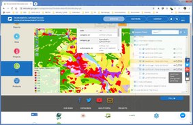
The results of the pilot study are available on the Environmental Information and Education Centre’s web portal.
Technical background
The main image for creating the land cover map for the base year 2018 was ortho-rectified Sentinel-2 imagery, which was downloaded from the Copernicus data portal. The European Space Agency (ESA) Sentinel-2 satellites carry a multi-spectral instrument with 13 spectral channels in the visible/near infrared and short-wave infrared spectral range at 10, 20 and 60 m ground resolution. To detect change, Sentinel-2 data from 2018 had to be compared with ETM imagery taken by the US Landsat 7 satellite in 2001 (seven spectral bands at 30 m ground resolution) and an Aster Terra 2001 image (14 spectral bands 15, 30, 90 m ground resolution) data. The main ancillary data were digital topographic maps at a scale of 1:10 000, updated between 1985 and 1989, IKONOS and Quickbird very-high-resolution satellite images from 2005-2010 and cadastre geodata at a scale of 1:2 000 from the National Registry of Georgia. Vector data for irrigation schemes were also used.