17 September 2019 | Vocational training on environmental accounting of land
The training took place at CIRAD [1] Maison de la Télédétection premises in Montpellier, France, from 2 to 6 September 2019.
In 2017, the EEA study of efficiency and effectiveness of recent environmental assessment reports in the Eastern Partnership countries recommended the use of modern tools and techniques for environmental assessment, including environmental economic accounting.
In 2019, the objective of the regional vocational training was institutional capacity development and production of new generation of indicators in order to implement land accounts and related indicators and set up environmental information systems. The first purpose of this training was to raise awareness of the feasibility of environmental accounting with current information and technology and following the EEA’s methodology, known as Land and Ecosystem Accounting (LEAC). The second objective was giving participants the opportunity to understand the practical use of land accounts in their national context, including for producing land-based indicators.
Eighteen experts from Armenia, Azerbaijan, Belarus, Georgia, Moldova and Ukraine participated in the 5-day training. The national team of experts consisted of one expert from the environmental authorities with experience of policy and compiling data/indicators, one expert from the statistical authorities with data handling experience and one expert from the land/cadastral/spatial authorities with a background in geographical information systems (GIS). The trainers provided by CIRAD assisted the country teams.
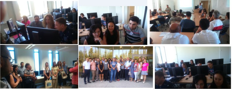
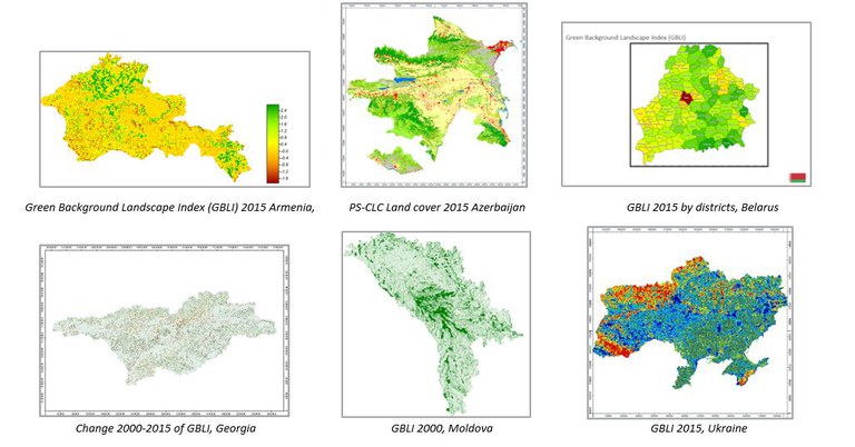
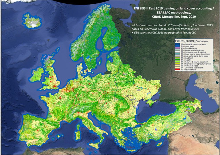
Theory and practice were reinforced through hands-on exercises with national data prepared by the CIRAD experts. To address the above-mentioned needs, land cover data sets had been prepared in advance, making full use of the new Copernicus Global Land Services data, which allowed a fully fledged implementation. To give a sense of expected outcomes in a pan-European perspective, a land cover map compatible with Corine Land Cover has been produced for the pan-European Eastern region using the new Copernicus Global Land Cover fraction layers for 2015 back-casted to 2000 with international data sets. It illustrates the kind of nationwide products that countries will get from implementing the national pilot of Corine Land Cover in parallel. The pseudo-Corine 2015 map is compatible with the United Nations SEEA land cover. EEA LEAC-type accounts have been produced by the participants from the six Eastern Partnership countries using SAGA Gis, a geo-scientific software package developed by the University of Hamburg. This included:
- production of land cover and land cover change accounts following the EEA’s LEAC/United Nations SEEA approach to monitor land degradation taking a natural capital approach (SDG indicator 15.3.1) in the six Eastern Partnership countries;
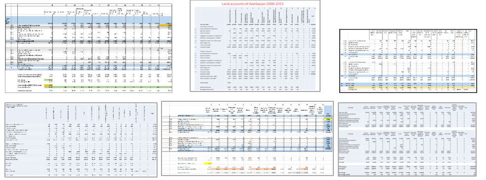
- analysis of stress factors causing urban sprawl (SDG indicator 11.3.1), epansion of agricultural area (SDG indicator 2.4.1.), deforestation (SDG indicators 15.1.1 and 15.1.2) and land uptake.
- production of various thematic maps derived from land cover accounts, e.g. self-assessment of progress in implementing SEEA by interviewing national experts attending this training, including questions on production and major constraints in compiling, dissemination and use of environmental accounts.
The conclusions of the training course were summarised in a national roadmap for land accounts and SEEA and discussed with the countries.
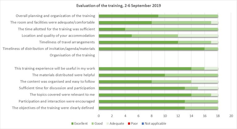
Participants rated the training as excellent to good.
[1] CIRAD, the French Agricultural Research Centre for International Development is an organisation working for the sustainable development. It is a public establishment under the joint authority of the Ministry of Higher Education, Research and Innovation and the Ministry for Europe and Foreign Affairs.
The event was covered by the Environmental Agency of the Republic of Moldova

